By Denise Starling, executive director of Livable Buckhead
PATH400 started as a straight line through Buckhead. Then the vision stretched north, south, east, and west until — somehow — we came full circle, right back to the original idea of creating a connected Buckhead network. It turns out the straightest path to the vision was not remotely straight, which, if you have ever worked on PATH400, will surprise absolutely no one.

The original idea was fairly simple: Build a trail through Buckhead that connects neighborhoods, parks, businesses, MARTA stations and the commercial core. But as the planning evolved, we realized PATH400 could become part of something much bigger — a regional network extending north into Sandy Springs and south to the Atlanta Beltline and Peachtree Creek Greenway. To make that larger vision possible, the regional spine had to come first. So, for years, I kept my head down and my vision almost painfully narrow, focused on one property owner, one permit, one funding source, one retaining wall and one seemingly impossible connection at a time. That is the strange thing about building a big vision: you have to become myopic to make it happen. You fight your way through one complicated piece after another and trust that eventually you will look up and discover that all those pieces have become something much bigger.
We are finally reaching that moment. Nearly 5 miles of PATH400 are now open in Buckhead, connecting neighborhoods, businesses, parks and four MARTA stations while creating places where people can exercise, gather, commute or simply experience Buckhead from an entirely different perspective. With the regional spine nearing completion and the remaining gaps moving toward construction, we can finally return to the original vision: Building a Buckhead network around PATH400. Apparently, we had to build the regional network before we could finish the neighborhood one. Classic PATH400.
Growing the Spine North
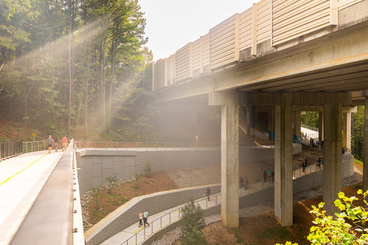
The most visible work is happening north of Loridans Drive, where crews are building the newest PATH400 section to the Atlanta–Sandy Springs city limits. This is not a polite little sidewalk project; this is trail building on hard mode. The terrain required enormous retaining walls, steep grades and a massive switchback that represents an impressive amount of engineering — and an equally impressive number of meetings.
Concrete is now being poured, and trail users will continue to see major progress this fall as crews complete final grading, additional concrete work, handrail installation and preparations for landscaping. Planting will occur during cooler weather, when new trees and shrubs have at least a fighting chance against Atlanta’s determination to roast everything we put in the ground.
Construction on the Atlanta portion is expected to be completed during the first quarter of 2027, although the exact public opening date will depend on final inspections, landscaping and coordination with Sandy Springs. That coordination matters because Sandy Springs’ portion is fully funded and moving forward, with the city prioritizing the section between the Atlanta city limits and Windsor Parkway so its trail can open with ours as soon as possible.
Trails do not care where one city ends, and another begins — and neither do the people using them. Rather than cut a ribbon at the city limit and leave everyone staring across an unfinished gap, Atlanta and Sandy Springs are working toward a coordinated opening that gives people a real connection to somewhere. Sandy Springs will even have a really cool bridge of its own. I am willing to admit that it may be almost as impressive as our treetop bridge at Mountain Way Common. Almost. Let’s not get carried away.
When the Atlanta and prioritized Sandy Springs sections open, PATH400 will extend approximately 7.4 continuous miles, connecting Buckhead north toward the Perimeter area. With Sandy Springs and Dunwoody also developing additional park and trail projects, this is becoming much more than an extension of one Buckhead trail. It is the beginning of a larger northern network.
Sewing Up the Southern Holes
The work heading south is less dramatic, but every bit as necessary. Two separate PATH400 projects are currently moving through the City of Atlanta’s procurement process, with construction on both expected to begin in early 2027 and wrap up later that year.
The first is the Peachtree Park connection, a short section that will link the commercial core at Peachtree Road to the Gordon Bynum Bridge, which marks the beginning of PATH400’s existing southern section. From Peachtree Road, the trail will dive between the InterContinental Buckhead Atlanta and Embassy Suites, travel briefly through the Peachtree Park neighborhood and connect at the bridge. From there, the existing trail continues past the “Great Blue” Mural and toward Miami Circle, where Eclipse di Luna sits directly along the route — and where, very conveniently, we hold Party on the PATH. We do appreciate it when our infrastructure and fundraising plans cooperate with one another.
The Peachtree Park connection is not long, but it is exactly the kind of small gap with an outsized ability to annoy us. Right now, the commercial core and the existing southern trail sit frustratingly close to one another without actually connecting. Completing this section will finally create a continuous route from Peachtree Road through Peachtree Park to the Gordon Bynum Bridge and into the southern PATH400 section.
The second project is at PATH400’s southernmost end, where the trail will meet the Atlanta Beltline. Rather than constructing an entirely new trail, the project will widen existing sidewalks into a full pedestrian and bicycle facility, with new signs and pavement markings identifying the route as PATH400 and guiding users toward the Beltline connection. This is also where PATH400 will ultimately meet the Peachtree Creek Greenway at a future convergence we affectionately call the “angel hair junction” — because apparently a normal trail intersection would have been too easy.
Together, these two projects will sew up the remaining holes in PATH400’s southern spine and connect Buckhead directly into Atlanta’s larger trail system.
Coming Back Home to Buckhead
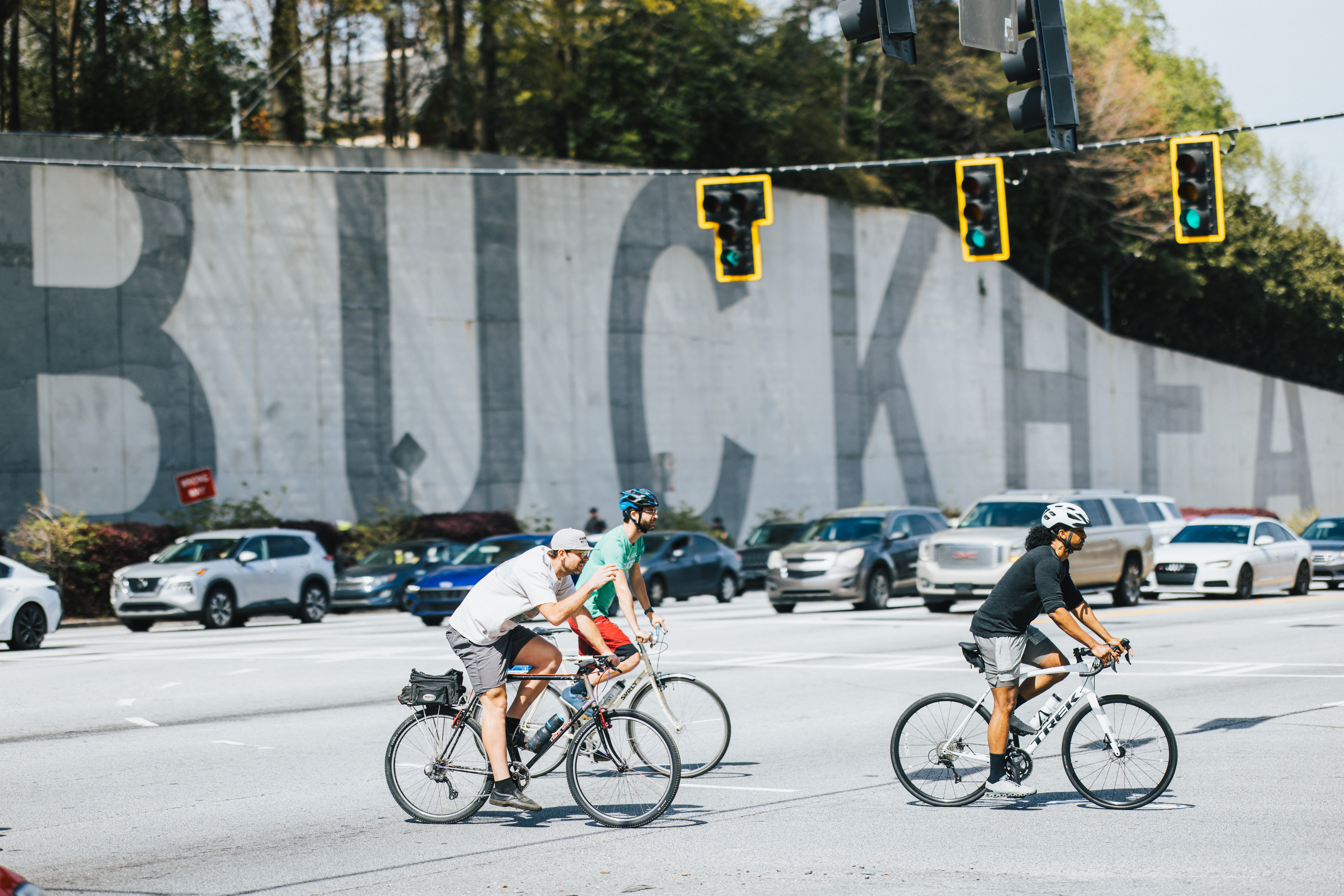
With the regional spine nearing completion, we can return to the vision that started all of this: using PATH400 as the backbone of a connected Buckhead network. The first challenge is anchoring the trail more firmly in the commercial core by determining the best way to connect Lenox Road at the BUCKHEAD wall to Peachtree Road.
The area has changed considerably since the original PATH400 plans were developed, so this is not a matter of dusting off an old drawing and calling it a day. We need a fresh vision developed with our partners at the Buckhead Community Improvement District and the commercial property owners along the route, and that planning effort will get underway next.
This connection is about much more than closing another gap on the map; it is about making PATH400 genuinely useful in the heart of Buckhead by connecting people to offices, hotels, restaurants, shopping, MARTA and the places they use every day.
Then we begin adding the connective tissue. To the west, Livable Buckhead is working with community and public-sector partners to explore a PATH400 connection to Blue Heron Nature Preserve and, eventually, Chastain Park. And this is where PATH400 really does need to be a polite little trail.
These are highly sensitive natural areas, so the approach cannot be the same one used for the massive retaining walls and switchback under construction to the north. The trail will need a lighter touch, carefully responding to streams, wetlands, wildlife habitat, tree canopy and the existing character of the places it is entering. That ability to change character is one of PATH400’s strengths. It is not one identical ribbon of concrete unrolling through Buckhead without regard for what surrounds it.
In the commercial core, PATH400 can be an urban transportation connection. Around Mountain Way Common, it becomes a treetop experience. Along Miami Circle, it connects businesses, art and nightlife. Near Blue Heron and Chastain, it must become quieter, more restrained and respectful of the natural environment. In other words, PATH400 should behave like a good guest: understand where it is, respond to its surroundings and avoid trampling through the room demanding attention.
The Blue Heron connection would give PATH400 users access to the preserve’s trails, wetlands, woodlands and environmental education programs. Continuing toward Chastain would connect the network to one of Atlanta’s largest and most heavily used parks, with its walking trail, playgrounds, athletic facilities, golf course, amphitheater and arts center. These routes would also bring neighborhoods west of Peachtree Road into the broader PATH400 system, but the goal is not simply to reach those destinations. It is to reach them in a way that protects what makes them worth visiting in the first place.
Inside the commercial core, future projects along Lenox Road and Piedmont Road can create equally important connections among PATH400, MARTA, businesses, neighborhoods and major destinations. These projects are still in earlier planning and partnership-building stages: Routes must be evaluated, property and infrastructure issues worked through, partners assembled and funding identified. In other words, all the glamorous behind-the-scenes work that happens for years before anyone gets to pose with a shovel.
But this is where the original idea becomes real. PATH400 is the backbone; Blue Heron, Chastain, Lenox Road, Piedmont Road, MARTA, our parks and our neighborhoods become the connective tissue. Together, they create a Buckhead network within Atlanta’s larger network. The regional connections make PATH400 bigger. The local connections are what will make it useful every day.
Building More Than a Trail
PATH400 has never really been about concrete. Concrete is simply the part you can see — and the part that makes a satisfying construction video. The real work has been bringing together people and organizations that did not always have an obvious reason to work together: neighborhood leaders, businesses, commercial property owners, city departments, elected officials, engineers, environmental organizations, MARTA, parks advocates and neighboring cities.
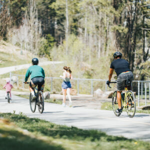
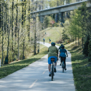
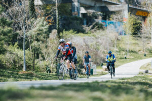
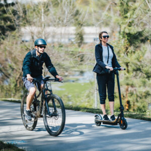
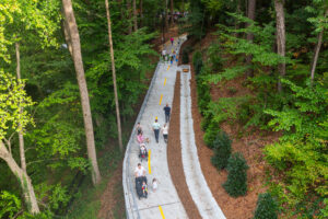
The trail gives us common ground — sometimes literally — and creates a reason to talk about how neighborhoods connect to businesses, how employees reach MARTA, how residents access parks and how Buckhead connects to the rest of Atlanta. Every new section gives people and organizations another opportunity to see themselves as part of the same community rather than as separate interests occupying the same geography.
The parks and gathering spaces along PATH400 are an important part of that work. Loridans Park is moving through the City’s procurement process, with contractor mobilization anticipated as construction on the northern trail section wraps up. Mountain Way Common is advancing through its stream-buffer variance process and will likely require additional fundraising once final costs are known. The City has also funded the design of an expanded vision for Old Ivy Park, including improvements on the east and north sides of the existing park.
These are not decorative extras attached to the trail. They are part of the network because connection is not only about getting from one place to another; sometimes it is about creating a place where people want to stop, stay, and encounter one another. That may be PATH400’s most important accomplishment. We set out to build a trail through Buckhead. Instead, we have been building a community around it.
So, When Will It All Be Finished?
The honest answer is that different pieces will finish at different times. The Atlanta section north of Loridans is expected to be completed during the first quarter of 2027, and Livable Buckhead and Sandy Springs are coordinating opening plans so the Atlanta trail and the prioritized Sandy Springs connection can open together. A joint celebration is being planned, with details to come once the construction schedule is firm.
The Peachtree Park and southern Beltline connections are expected to enter construction in early 2027 and be completed later that year. The Lenox Road-to-Peachtree Road connection will follow a separate planning and design process, beginning with the new vision developed with the Buckhead CID and commercial property owners. The Blue Heron, Chastain, Lenox Road and Piedmont Road connections will take longer because they remain in the planning, partnership and funding stages.
Schedules are real, but they are not carved into stone — especially when a project involves government approvals, utilities, major roads, private property, railroads and Mother Nature, all of whom enjoy having opinions and very few of whom respect my preferred timeline. In the meantime, existing sections of PATH400 will remain open, although users should watch for construction signs and temporary closures near active work areas.
There will also be opportunities to celebrate and support the work. Party on the PATH returns Sunday, October 4, at Eclipse di Luna on Miami Circle, right along the existing southern trail. The evening begins with a VIP reception at Johnson Lowe Gallery before moving into the main party for tapas, cocktails, music and dancing. It is Livable Buckhead’s annual fundraiser, which means you can have a very good time while helping us keep the PATH400 network moving forward. We consider that efficient multitasking.
There is still plenty of work ahead, but the story has come full circle. We began with a vision for a connected Buckhead network, then built the regional spine needed to tie it into Atlanta’s larger system. Now we are returning to finish the local network around it. PATH400 will connect Buckhead north to Sandy Springs and south to the Beltline and Peachtree Creek Greenway — but it will also connect Buckhead to itself.
That was the original idea. It just took the scenic route getting here.